| |
|
|
|
|
|
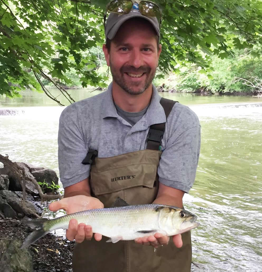
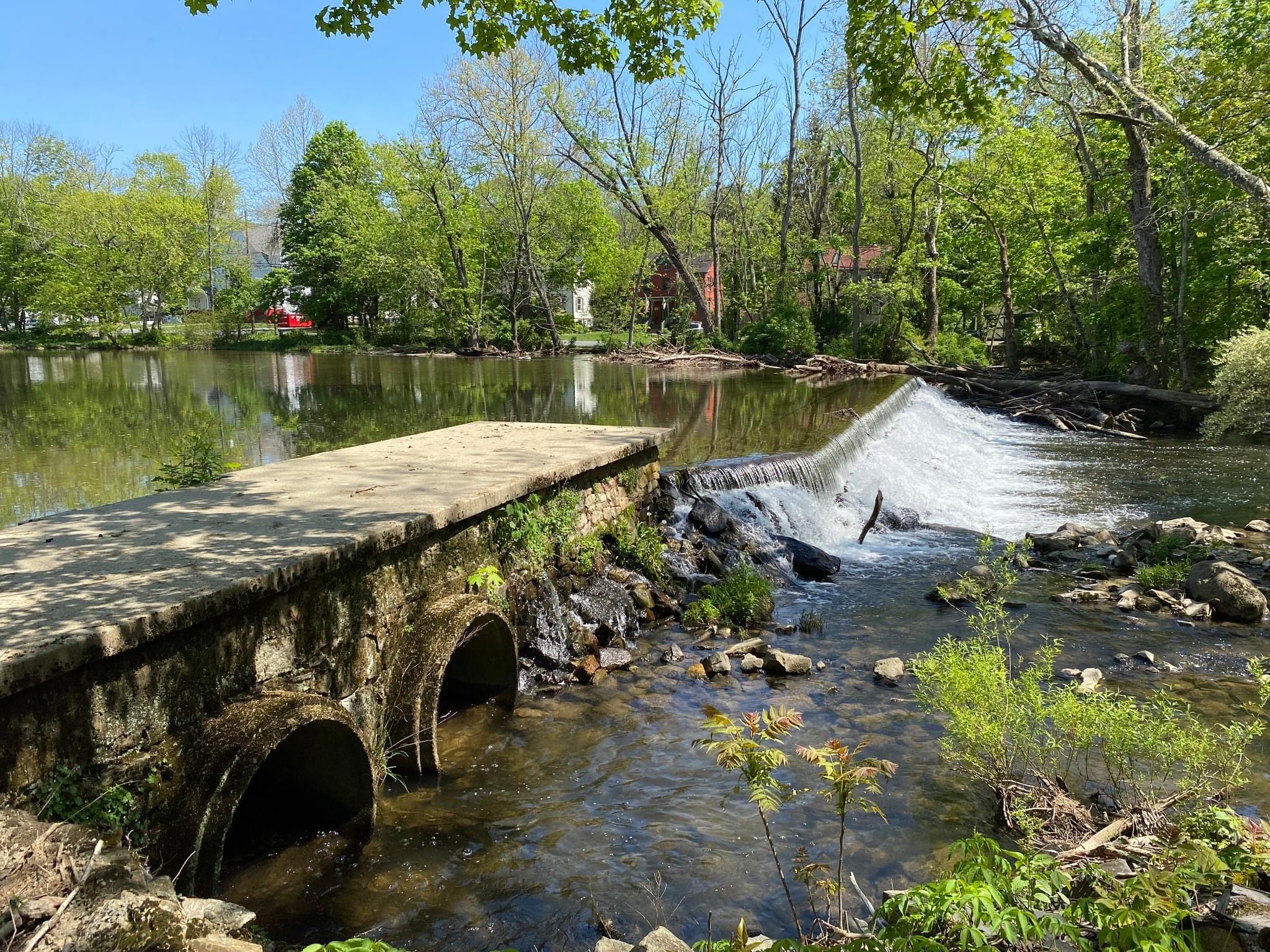
The Paulins Kill is a 41.6-mile tributary of the Delaware River in northern New Jersey. The downstream-most barriers, the Remnant and Columbia Dams, prevented anadromous fish, including American shad and river herring, from accessing the river for over a century. Located 0.1 miles upstream of the confluence with the Delaware River, construction began on the Remnant Dam in 1901 to provide hydropowe. . . read more!
|
|
| |
|
|
|
|
|
The Musconetcong River is a 45.7 mile tributary of the Delaware River in northern New Jersey. It supports one of New Jersey's most important trout fisheries, and is classified and managed as a Category 1 (C1) trout maintenance stream due to its cold water and suitable habitats that support trout year-round. A 24.2 mile section of the river was also designated as a National Wild and Scenic River by. . . read more!
|
|
| |
|
|
|
|
|
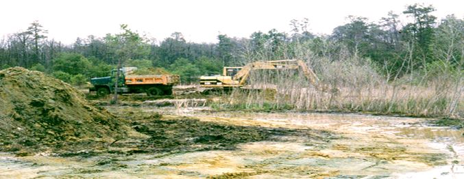
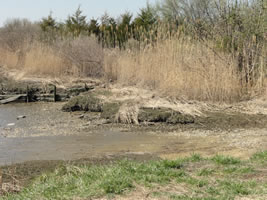
On-site remedial activities at the Lone Pine Landfill included the construction of a slurry wall, capping the landfill, and the installation of a groundwater treatment system. As a result, approximately 34 acres of wetlands were either temporarily or permanently altered. To compensate for injuries to natural resources as a result of the release of hazardous materials and subsequent remedial activi. . . read more!
|
|
| |

|
|
|
|
|
On-site remedial activities at the Lone Pine Landfill included the construction of a slurry wall, capping the landfill, and the installation of a groundwater treatment system. As a result, approximately 34 acres of wetlands were either temporarily or permanently disturbed. To compensate for injuries to natural resources, specifically bottomland hardwood wetlands, as a result of the release of haza. . . read more!
|
|
| |
|
|
|
|
|
To compensate for injuries to migratory birds and shoreline habitat caused by the M/T Athos I oil spill, the Trustees proposed a wetland restoration project at Mad Horse Creek Wildlife Management Area. The 260-acre restoration site contains tidal marshes, transitional wetlands invaded by common reeds (Phragmites), and wetland areas that were filled in for upland agricultural use. A large portion o. . . read more!
|
|
| |
|
|
|
|
|
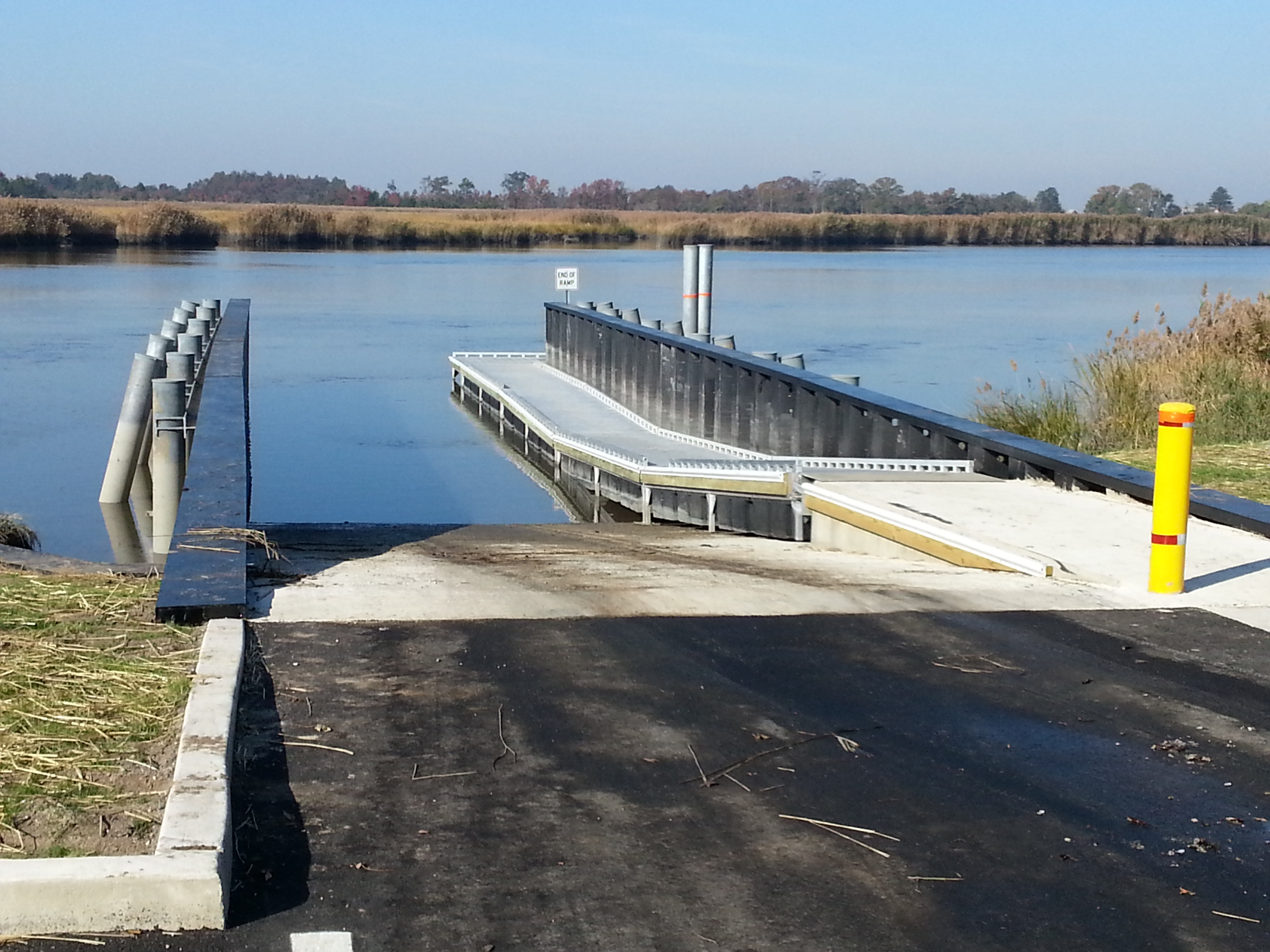
To compensate for the loss of recreational opportunities caused by the M/T Athos I oil spill, improvements were made to the boat ramp at Stow Creek State Park. Though extremely narrow, short and in poor condition, the existing boat ramp was heavily used by the public. Located along Stow Creek, the boat ramp offers access to the tidal marshes of the Mad Horse Creek Wildlife Management Area and Dela. . . read more!
|
|
| |
|
|
|
|
|
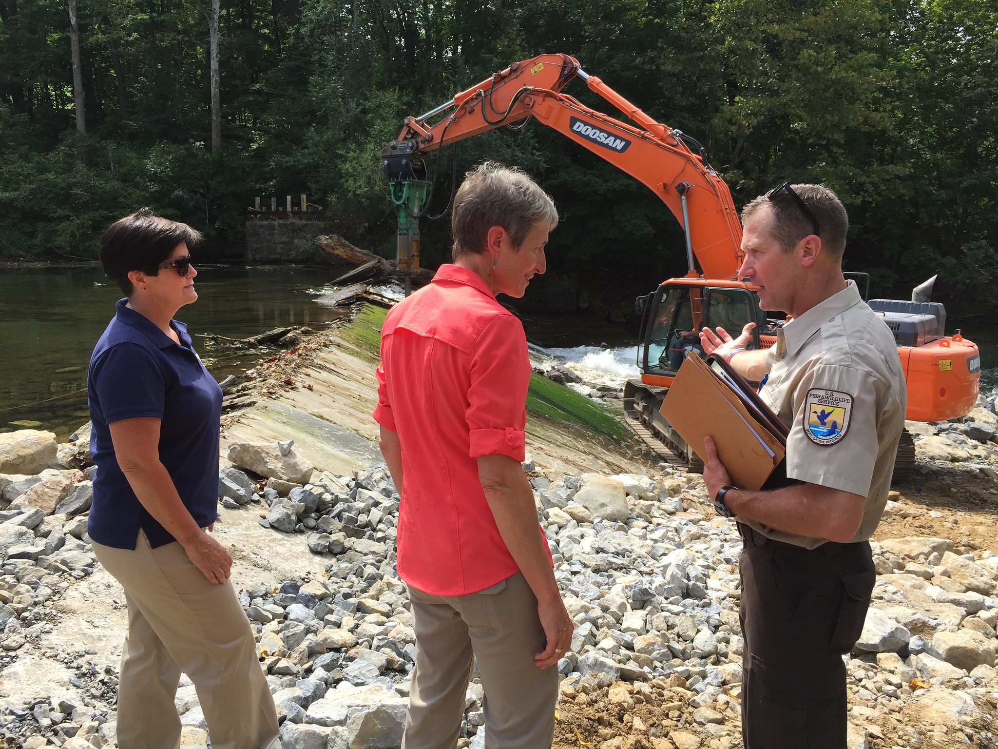
The Nunn's Mill Dam is located on the South Branch Raritan River in Washington Township, NJ. It was constructed over 100 years ago to power a small mill that has not been in use for some time. Approximately 40 feet of the dam is a concrete gravity spillway and the remaining 110 feet is an earthen embankment. The dam forms a 2.5-acre impoundment that accumulates sediment and has become shallow and . . . read more!
|
|
| |
|
|
|
|
|
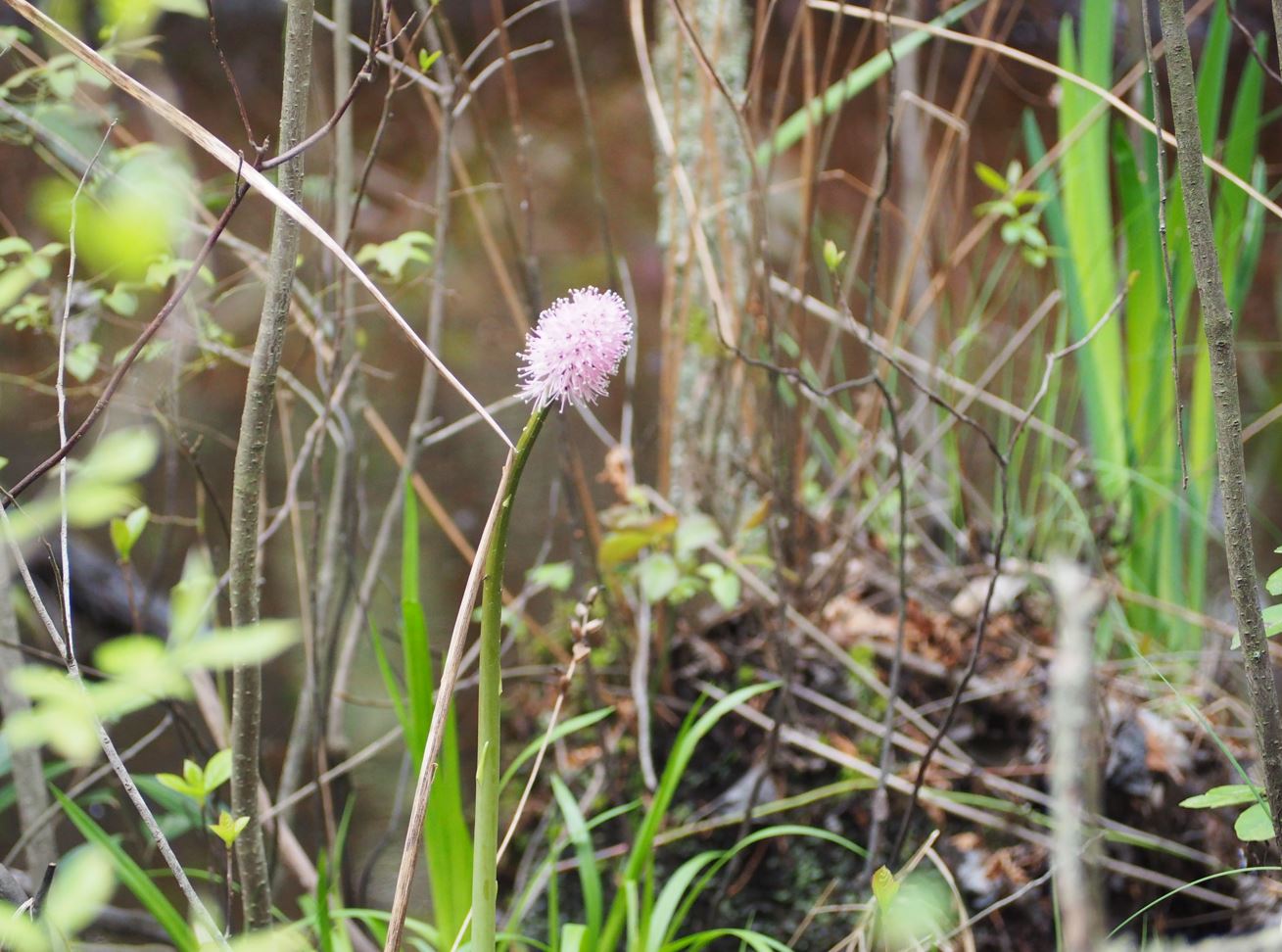
Swamp pink is a perennial herb native to the eastern United States. Historically, swamp pink ranged from Staten Island to the southern Appalachians but today is found in disjunct populations on the coastal plain of New Jersey, Delaware and Maryland, and along isolated headwater streams and mountain bogs from Virginia to Georgia. In New Jersey, the plant can be found growing on hummocks in swamps d. . . read more!
|
|
| |
|
|
|
|
|
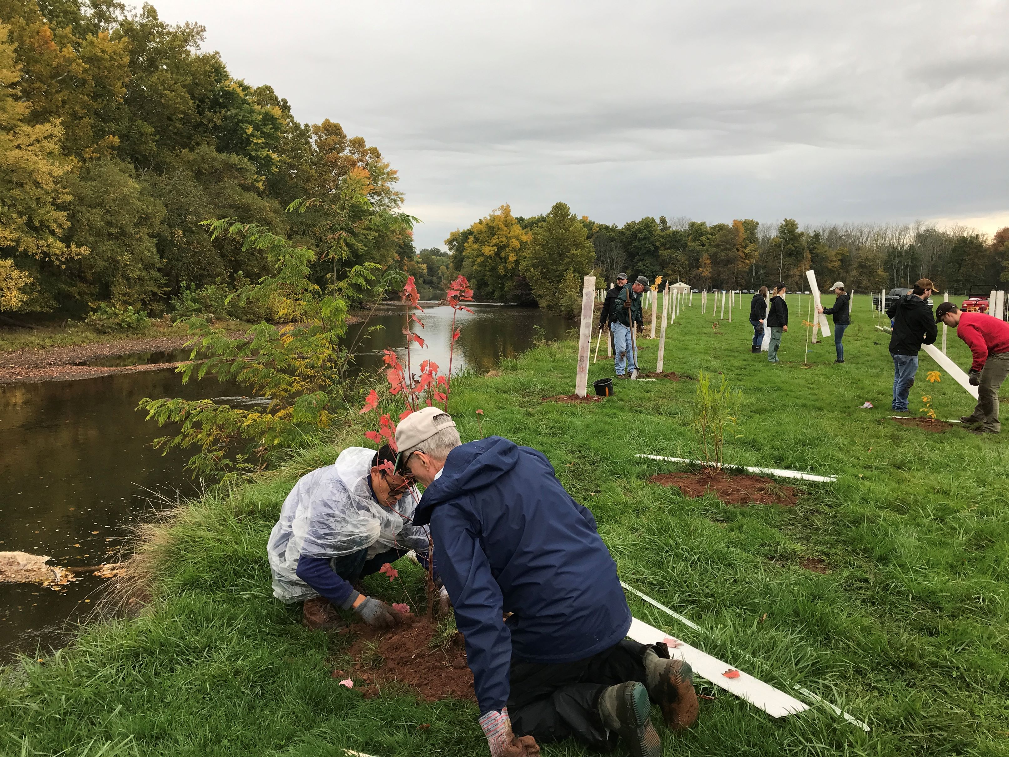
The North Branch Raritan River is a large tributary of the Raritan River. Its headwaters begin in Raritan Pond in Mendham Borough, NJ and it flows generally southwest through Somerset County until it joins the South Branch Raritan River to form the mainstem near Bridgewater. In recent years, the non-profit Raritan Headwaters Association (RHA) analyzed land cover and water quality data collected fr. . . read more!
|
|
| |
|
|
|
|
|
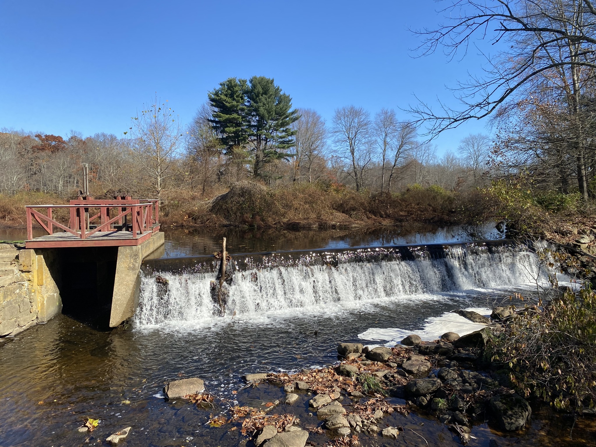
The Cole's Mill Dam in Califon, NJ (also known as the Califon Dam) was constructed between 1830 and 1840 to provide power to a small gristmill along the South Branch Raritan River but fell into disuse and was considered obsolete by the end of the century. Most dams in New Jersey are well over 100 years old, no longer used, and at risk of falling into disrepair. This combination often leads to unwa. . . read more!
|
|
| |
|
|
|
|
|
The Cornell-Dubilier Electronics Trustees partnered with a private landowner in Readington Township, NJ to complete the removal of a small weir and farm pond on an unnamed stream that flows into Rockaway Creek, a tributary of the Lamington River. The weir was approximately 15-foot-wide and created a small, shallow pond that trapped sediment and experienced extensive aquatic plant and algal growth . . . read more!
|
|
| |
|
|
|
|
|
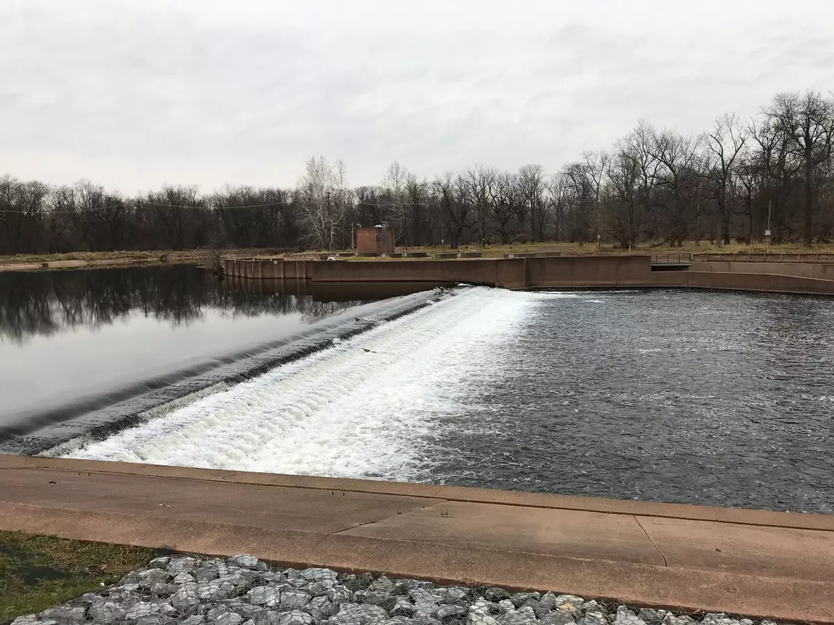
Island Farm Weir (IFW) is a low head dam located immediately downstream of the confluence of the Raritan and Millstone Rivers. IFW was constructed in 1994 to supplement New Jersey's public water supply and is currently the downstream-most barrier on the Raritan River. A concrete vertical slot fishway was installed during the construction of IFW but recent fish passage studies conducted by the NJ D. . . read more!
|
|
| |
|
|
|
|
|
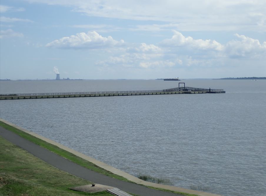
Fort Mott State Park is located along the eastern bank of the Delaware River in Pennsville, NJ. Due to its strategic position near the mouth of the river, the federal government purchased Pea Patch Island and several acres of land at Finn's Point, NJ during the 1800s to develop coastal defenses to protect the cities of Philadelphia, PA, Camden, NJ, and Wilmington, DE from naval attack. Fort Delawa. . . read more!
|
|
| |
|
|
|
|
|
The Harrison Avenue Landfill in the Cramer Hill neighborhood of Camden, NJ was an 86-acre unregulated municipal landfill located adjacent to the confluence of the Cooper and Delaware Rivers. The landfill operated from approximately 1952 until 1971 but was never officially closed or capped. For almost 50 years, the abandoned landfill was subjected to illegal dumping. In 2018, the New Jersey Departm. . . read more!
|
|
| |

|
|
|
|
|
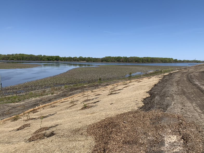
The 182-acre Quashne property in Lower Alloways Creek Township, NJ was acquired in 1997 using a portion of the M/V Presidente Rivera oil spill settlement funds, and is now a part of the Mad Horse Creek Wildlife Management Area. Past agricultural practices on the property included altering and filling the brackish tidal marsh, resulting in common reeds (Phragmites) invading the wetland. Prior to th. . . read more!
|
|
| |

|
|
|
|
|
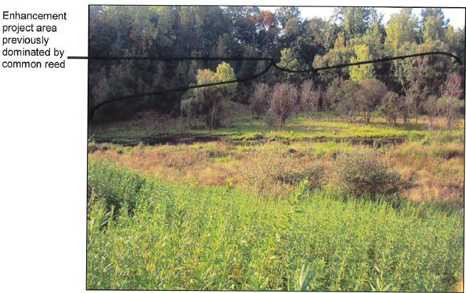
The 186-acre Wozniak property was acquired in 2000 using M/V Presidente Rivera oil spill settlement funds, and incorporated into Stow Creek State Park. Past agricultural practices have altered the hydrology of the marsh allowing common reeds (Phragmites) to invade the wetland. This decreased the productivity of the marsh and significantly reduced its habitat value for many species of wildlife.
. . . read more!
|
|
| |

|
|
|
|
|
The 457-acre Tidemarsh, Inc. property in Elsinboro, NJ was acquired in March 2008 using M/V Presidente Rivera oil spill settlement funds and became a part of the Abbotts Meadow Wildlife Management Area. Tidemarsh, Inc., a local hunting club, retained approximately 15 acres surrounding their cabin that is now covered by a conservation easement restricting further development. A large portion of the. . . read more!
|
|
| |
|
|
|
|
|
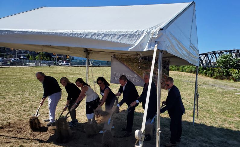
In August 2022, construction began on a 5-acre urban park located along the Passaic River in East Newark, NJ. The park will include walking paths, an elevated walkway along the river, pollinator gardens, plantings of native trees and vegetation, a small wetland area, and open green spaces for recreation. When complete, the East Newark Riverfront Park will provide public access to the Passaic River. . . read more!
|
|
| |
|
|
|
|
|
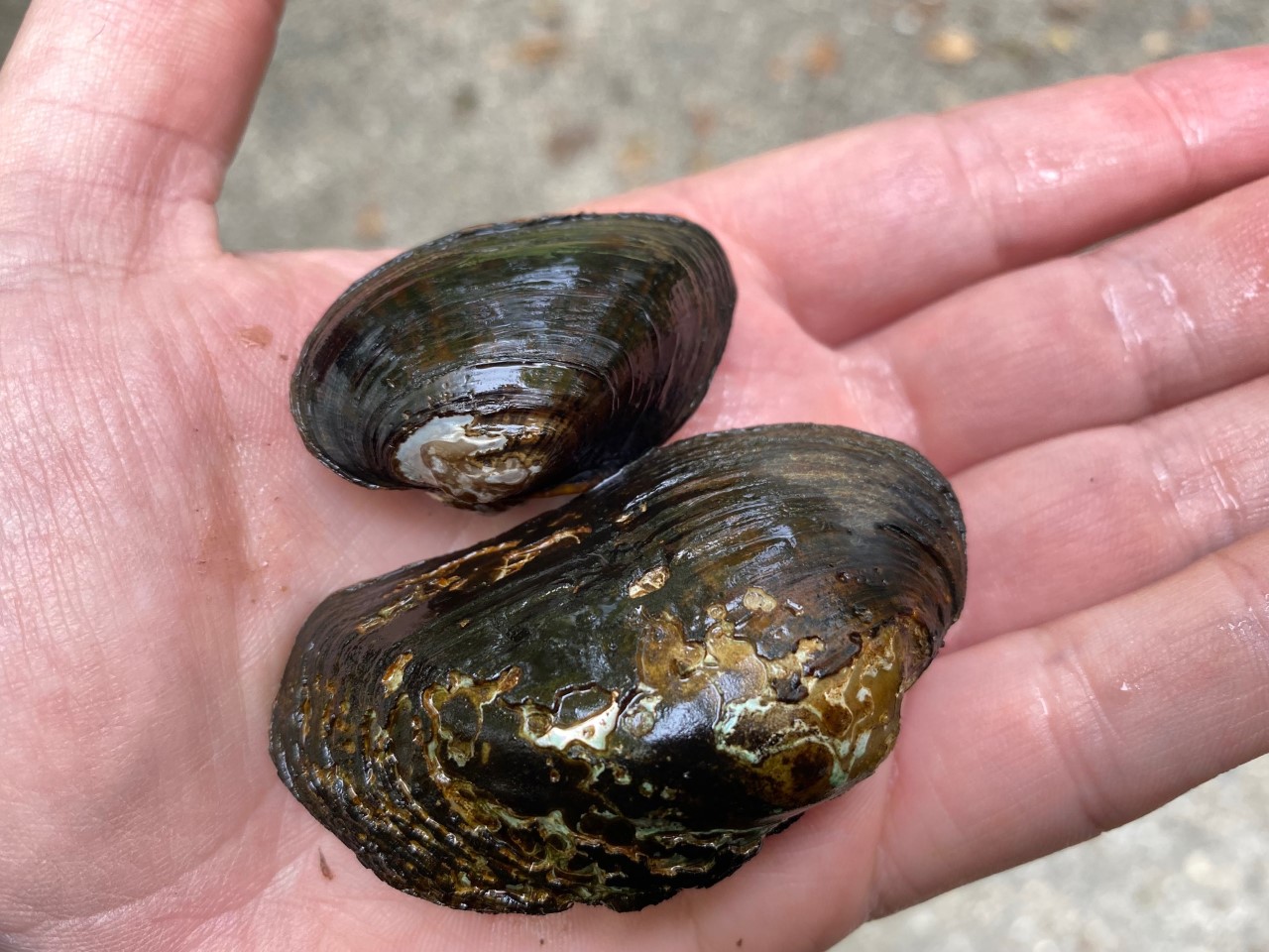
Freshwater mussels are critical to riverine and stream ecosystems, as they help purify the water as they filter feed on algae, plankton and detritus. They are also an important food source for many species including river otters, raccoons, and muskrats. Freshwater mussel populations in decline due to habitat loss and degradation, alterations in water flow, intense flooding, the loss of host fish, . . . read more!
|
|
| |
|
|
|
|
|
During the remediation of the Caldwell Trucking Co. NPL Site, contaminated soil in the Extended North Lagoon Area (ENLA) was excavated and removed, resulting in the disturbance of approximately 0.62 acres of herbaceous freshwater wetlands. Of this, about 0.09 acres were permanently altered to stabilize the excavated soil. After the remedial activities concluded, the New Jersey Department of Enviro. . . read more!
|
|